You may have heard the age-old riddle: What gets wetter as it dries?
And while some people know that the answer is "a towel," many others don't know the surprising alternate answer is actually our planet.
Interestingly enough, the Earth is simultaneously getting wetter and drier as it heats up. So, how does this happen?
The 'DGDWGW' paradigm
In environmental science, you may see the acronym DGDWGW, which stands for "dry gets drier, [as the] wet gets wetter."
Basically, the idea is that as the Earth warms, dry parts of the world will continue to become drier, while areas of the world that see a lot of rain may get more severe downpours.
Deke Arndt, who runs the National Centers for Environmental Information (NCEI), explained in a blog post:
TCD Picks » EDF Spotlight
💡EDF's Vital Signs newsletter delivers stories about game-changing solutions close to home and around the world


"A warmer atmosphere can hold more water vapor, and an atmosphere with more water vapor can make more precipitation," Ardnt wrote.
Essentially, when it rains, it pours.
And when wet regions of the world see even higher temperatures, more of the water in lakes, rivers, and soils evaporates, leading to bigger rain events and worse floods.
On the flip side, areas that don't usually get a lot of rain are also experiencing an increase in evaporation, leading to drier vegetation, waterways, and soils. Together, this means that dry areas will have worse droughts as the Earth continues to overheat.
The U.S. as a case study
The U.S. is a great example of DGDWGW.
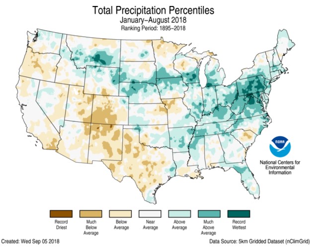
In the map above from 2018, you can see that the dry parts of the U.S., like California and New Mexico, are dealing with very dry conditions, some experiencing record dry spells. At the same time, areas of the Northeast are seeing record-wet seasons.
But the trend isn't contained to the borders of the United States.
Across the world, we're seeing drier and wetter conditions wreaking havoc and worsening natural disasters.
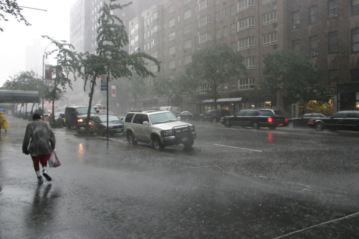
With wetter conditions, hurricanes and typhoons are intensifying more quickly and are more frequently extremely powerful. And unfortunately, this means more expensive and deadly weather events.
California, one of the nation's driest regions, also exemplifies how an overheating planet makes rain patterns far stranger.
Even though California has been in a "megadrought" for years, with some areas seeing their driest conditions in the past 1,200 years, the state has been making headlines for its intense rain and snow events.
In early January, about 90% of California residents were under a flood watch, and in some areas, including Santa Barbara, at least 16 inches of rain fell in just two days.
Streets are floated in Santa Barbara's east side. You can see a man kayaking down the street. pic.twitter.com/qrwTKtzN6e
— Ryder Christ (@RyderChristNews) January 9, 2023
And this past week, some of California was battered by snow, surprising residents not used to such intense wintery conditions or blizzard warnings.
Suddenly I'm in Alaska #CaliforniaSnow pic.twitter.com/6wDTG1gxFQ
— Mallory (@MalloryTheMyth) February 25, 2023
One might think that rain and snow pummeling the Golden State in the past two months means that it's not dealing with the impacts of dry conditions.
Yet, as of Feb. 21, more than 99.39% of the state is still dealing with what is considered to be "abnormally dry conditions" and about a third of the state is still in a "severe drought."
A warming world is one that deals with stranger weather, not just droughts and dry spells. So the next time you see headlines about droughts and floods in the same newspaper, you can use the DGDWGW paradigm to make sense of the craziness.

Join our free newsletter for cool news and cool tips that make it easy to help yourself while helping the planet.