Someone built a tool using Google Maps' 3D view that lets you actually see the water rise, meter by meter, on familiar streets. It's pretty jarring.
What's happening?
This tool is the "Sea Level Rise 3D Map," by developer Akihiko Kusanagi, according to Meristation.
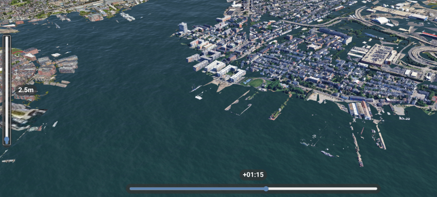
It's interactive — you use a slider, and a blue layer shows water creeping over coastlines and into cities. It uses tech like deck.gl, is open source on GitHub, and gives a different, alarming perspective than flat maps.
Why is sea-level rise concerning?
This isn't hypothetical; sea levels are rising faster now. It's happening because the planet's overheating, mostly from burning dirty energy, which pumps heat-trapping pollution into the air.
Meristation points out two big reasons: warmer oceans expand (soaking up over 90% of extra heat!) and melting ice sheets dump billions of tons of water into the sea. Just one centimeter of rise can push the coastline back a meter.
That spells trouble for communities. We're already seeing impacts. One report highlighted Florida's Key Largo tree cactus going locally extinct, partly because saltwater got into its freshwater supply. Worse, another analysis showed that huge chunks of the U.S. coast could be underwater by 2100 if things get really bad.
All that melting ice isn't just raising water levels; it's disrupting global climate patterns.
As climate scientist Dr. Ariaan Purich warned the Guardian in 2023, "Antarctica might seem remote, but changes around there can affect the global climate ... [affecting] coastal communities around the world."
While bad weather happens, science suggests this overheating acts like steroids for weather, making storms much worse.
What can be done about sea-level rise?
Tools like this map and Climate Central's Google Earth videos help visualize what experts, like the IPCC, are saying.
TCD Picks » Quince Spotlight
💡These best-sellers from Quince deliver affordable, sustainable luxury for all


|
Do you feel like the air quality is safe where you live? Click your choice to see results and speak your mind. |
Their projections show sea levels rising 43 to 84 centimeters (1.4 to 2.8 feet) by 2100, even with action. Seeing it makes it feel real. The main fix is cutting heat-trapping pollution from dirty fuels.
That's the big lever. Daily choices, like using less plastic or making homes energy-efficient, add up. Getting informed about critical issues helps, too. People are working on adapting — think smart reefs or Singapore reclaiming land.
Being ready for rough weather makes communities stronger. Ultimately, this simulator isn't just about pixels on a screen; it's a powerful reminder that the choices we make today really do shape the world our communities will face tomorrow.

Join our free newsletter for weekly updates on the latest innovations improving our lives and shaping our future, and don't miss this cool list of easy ways to help yourself while helping the planet.