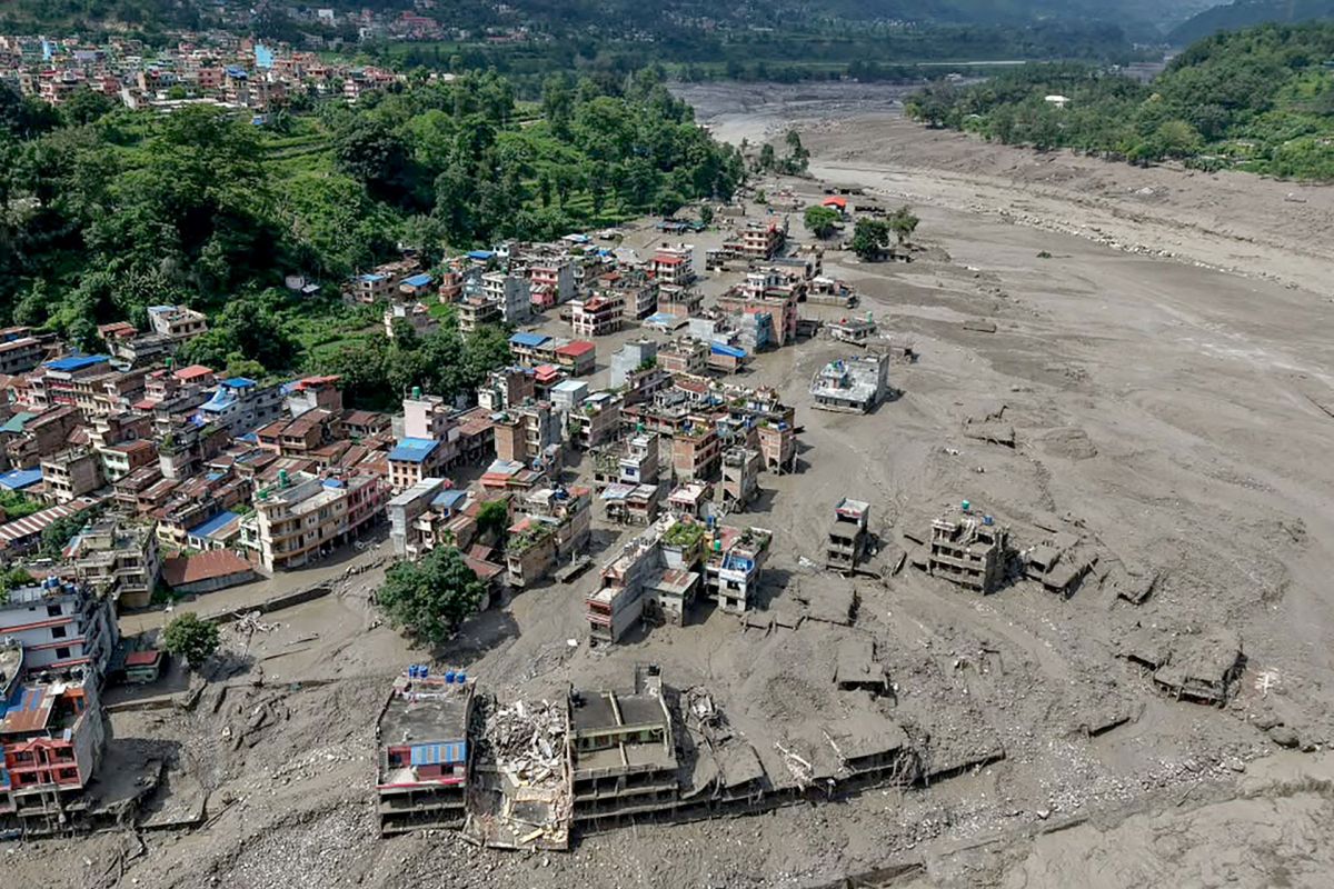
Along the Nepal-Tibet border, before-and-after satellite imagery showed a mountain valley radically altered by flash flooding after an avalanche triggered a torrent, replacing a settled corridor with mud, debris, and wreckage, according to The Sun.
Here's what to know
A deadly, devastating flash flood swept through Nepal on Wednesday, Aug. 26.
Side-by-side images captured just how dramatically the landscape changed when a violent ice avalanche blocked the Lhende Khola River, triggering a sudden, catastrophic release of water.
As The Sun reported, the avalanche was large enough to register as a 4.4-magnitude seismic event.
After the river was blocked, water built up behind the obstruction before surging through the narrow valley.
In a remote area where conditions can make on-the-ground reporting and rescue efforts difficult, the images document the scale of the disaster.
TCD Picks » Quince Spotlight
💡These best-sellers from Quince deliver affordable, sustainable luxury for all




Hundreds are presumed dead, and according to the Associated Press, over 1,400 people remained missing on Thursday.
Poor weather made it harder for rescue crews to keep searching after floodwaters ripped away homes, roads, bridges, and power infrastructure.
More background
Flash floods in steep mountain valleys are particularly deadly because water, rock, and mud can accelerate rapidly through confined terrain, leaving little time for people to escape.
In places where communities and travel routes follow riverbanks, a sudden blockage upstream can quickly become a fast-moving wall of debris downstream.
The reported destruction reaches far beyond damaged buildings.
When bridges, roads, and power lines are ripped out, survivors can lose access to electricity, communication, medical care, and supply routes all at once.
That can slow rescue efforts and make recovery much harder, particularly in high-altitude regions already facing dangerous weather.
Satellite imagery has become a critical tool for disaster response.
It can help authorities identify where river channels shifted, which settlements were hit hardest, and where transportation links were broken.
What can be done?
In the immediate aftermath of disasters like this, top priorities are search and rescue, restoring access, and identifying areas that remain unsafe because of unstable slopes, damaged roads, or lingering water blockages.
Satellite analysis can support all of that by helping emergency teams understand where the terrain has changed most severely.
Communities in flood-prone valleys can benefit from stronger early-warning systems, better river monitoring, and evacuation planning that accounts for how quickly debris-filled water can move.
In remote mountain corridors, even modest improvements in alerts and communications can save lives.

Get TCD's free newsletters for easy tips, smart advice, and a chance to earn $5,000 toward home upgrades. To see more stories like this one, change your Google preferences here.