When one college student set out to map every concentrated animal feeding operation in the U.S., she didn't realize what a thorny question it would be.
Animal feeding operations (AFOs) are defined by the EPA as "agricultural operations where animals are kept and raised in confined situations" for 45 days or more in a 12-month period, without any crops being grown there in between. They become concentrated animal feeding operations (CAFOs) if they meet certain size requirements, or produce so much pollution that their size doesn't matter.
That pollution was why Rachael Ann Nicoletta focused on CAFOs as the subject of her mapmaking project. "My initial project topic focused on CAFOs and studying the ways individual facilities impacted nearby environments," she said in the write-up of her findings. "I wanted to map all CAFOs in the United States and branch from there based off of the patterns I found."
There was just one snag: The information she needed was nowhere to be found. "Unfortunately, data on CAFOs such as locations in every state was difficult to come across, as I realized all states had varying laws and regulations on what data farms are required to share," she said.
So instead, that very lack of transparency became her new project.
In addition to a map showing the estimated number of CAFOs in each state, Nicoletta also created one showing why she couldn't get more specific data for her project.
Her updated map shows how transparent each state is about several types of CAFO data, including locations, sizes, ownership, and how manure is stored at each site.
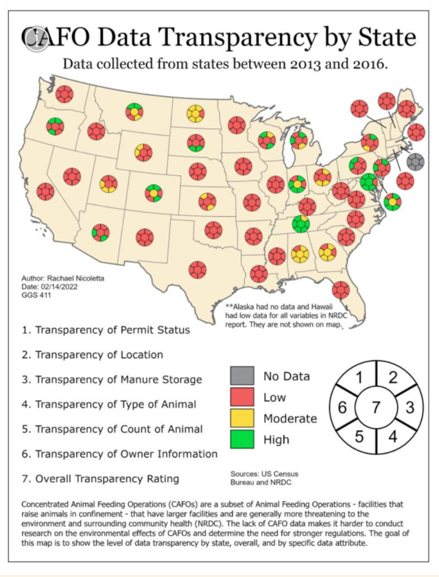
She also gave each state a general transparency ranking, with green being highly transparent and red indicating low transparency.
The map is a sea of red.
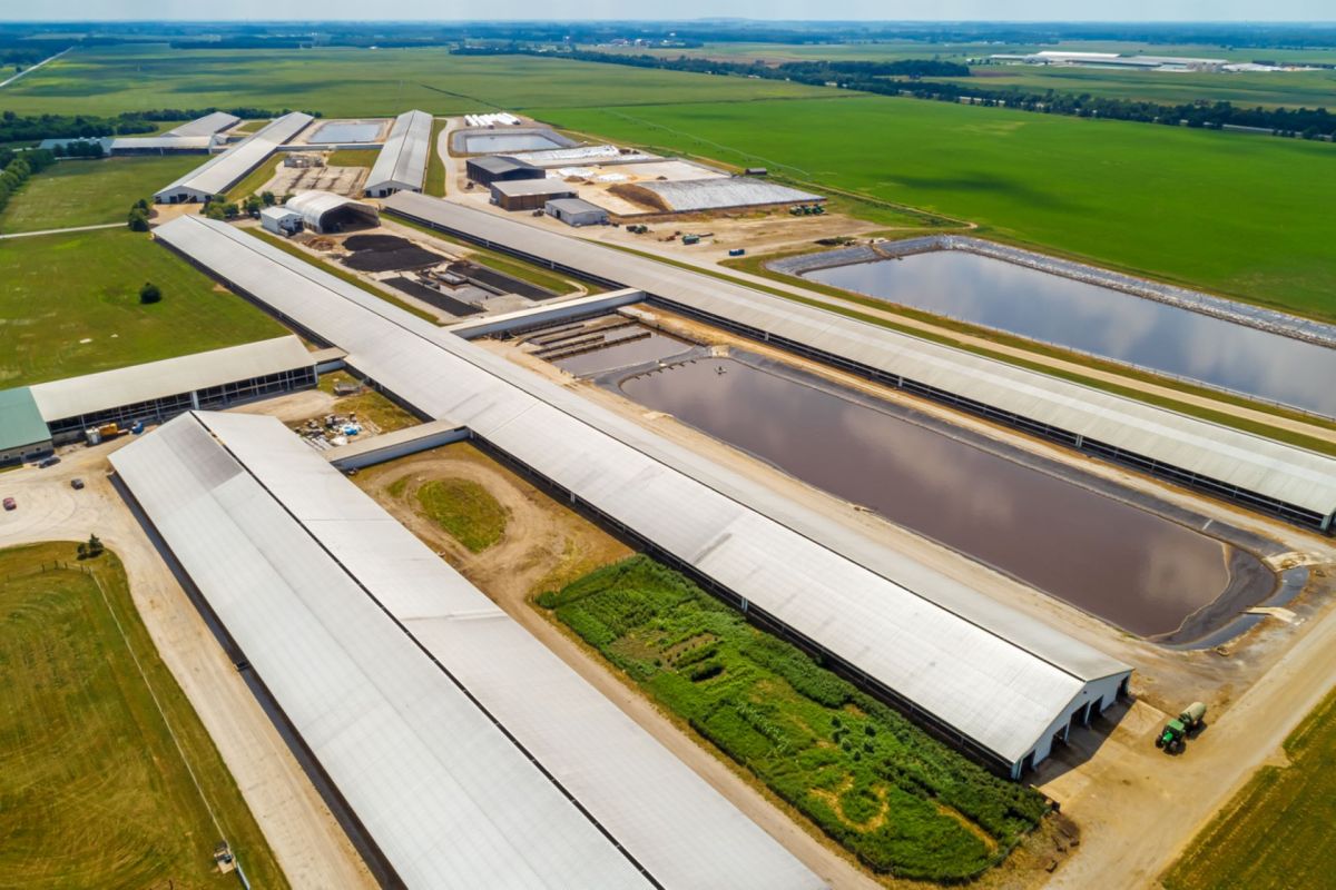
This is a huge problem for residents because, as the National Resource Defense Council pointed out, CAFOs pollute the surrounding groundwater and even the air with diseases, toxins, and dangerous particulates. This results in asthma, lung disease, and bronchitis in nearby residents and workers, and damage to the wildlife in nearby ecosystems — and people may not even know about it.
TCD Picks » Quince Spotlight
💡These best-sellers from Quince deliver affordable, sustainable luxury for all


Even the antibiotics used on the animals are contributing to the development of antibiotic-resistant "superbugs," the NRDC claimed.
Nicoletta thought there should be a change. "The public has the right to know where CAFOs are or are being constructed so they can prepare as needed," she concluded.

Join our free newsletter for cool news and actionable info that makes it easy to help yourself while helping the planet.