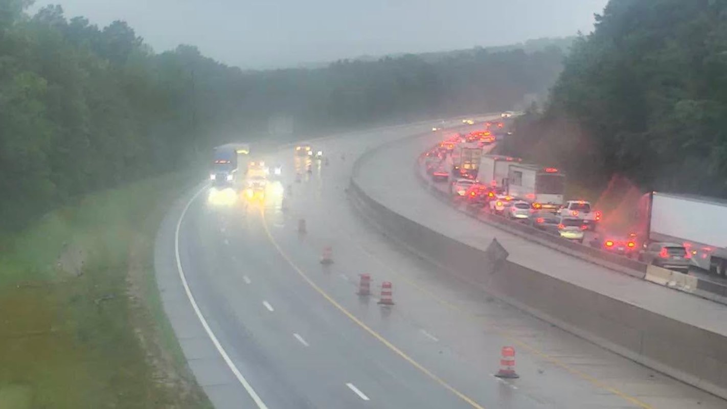
Heavy rain hammered central North Carolina on Thursday. Flooding caused downed trees, blocked roads, and power cuts to thousands of homes and businesses, according to WRAL.
Forecasters said additional rain was still passing through the area, and officials cautioned that drivers often cannot accurately judge the depth or danger of water from inside a vehicle.
What's happening?
Rain totals mounted quickly across the middle of the state early Thursday, raising alarms from the Triad to the Triangle. As WRAL reported, High Point had already recorded more than 6 inches by 5 a.m., while Burlington, Greensboro, and Winston-Salem were also in the several-inch range.
Flood alerts widened as the morning went on. By midmorning, a flash flood warning was in effect for Chatham, Harnett, Lee, Moore, and southwestern Wake counties, alongside flood advisories for Wake, Durham, Chatham, Orange, Person, and Granville counties. WRAL meteorologist Elizabeth Gardner said the Triad had already picked up about 1 to 3 inches of rain, with more on the way.
Water-covered roads quickly created transportation problems. WRAL reported that flooding shut down part of I-40 Westbound in Orange County, and crews responded to multiple crashes, including a wreck on Interstate 440 West in Raleigh and another in Garner on U.S. 70 at N.C. 50 that left a vehicle in a ditch.
Storm-related outages were also reported in several places. WRAL said Duke Energy's outage map showed about 2,000 Durham customers without power at one point. More than 2,500 customers were also without power earlier in the morning in Chatham County, hundreds more in Wake and Orange counties, and more than 8,000 outages near High Point.
TCD Picks » Quince Spotlight
💡These best-sellers from Quince deliver affordable, sustainable luxury for all




Why does it matter?
Flooding remains one of the most immediate and deadly weather threats. Even shallow water on a roadway can stall a vehicle, sweep away a car, or hide damage beneath the surface.
Water that seems shallow can also be much deeper than it looks, especially if there is a hidden ditch or pothole underneath the water.
Road closures and power outages can disrupt work and delay emergency response. And warmer air can hold more moisture, increasing the likelihood of intense downpours in some storms.
What's being done?
As crews worked through the storm's fallout, emergency responders and utility workers were already handling flooded roads, stranded vehicles, fallen trees, and damaged equipment.
In Orange County, the Orange Rural Fire Department said on Facebook, "We are responding to multiple calls for flooded roads, cars in the water and trees down."
Officials are urging residents to change their travel plans instead of trying to drive through standing water. If roads are flooded, the safest option is to avoid them altogether, delay your trip if possible, and check local alerts before heading out.
Residents can also reduce their risk by charging phones and backup batteries, keeping flashlights nearby, avoiding downed power lines, and reporting outages directly to their utility provider. Anyone who relies on refrigerated medication or electric medical devices should make a backup plan as soon as possible.
If driving is unavoidable, experts say to slow down and watch for ponding, especially near low roads. Conditions can change quickly as rain bands continue moving south through the day.

Get TCD's free newsletters for easy tips, smart advice, and a chance to earn $5,000 toward home upgrades. To see more stories like this one, change your Google preferences here.