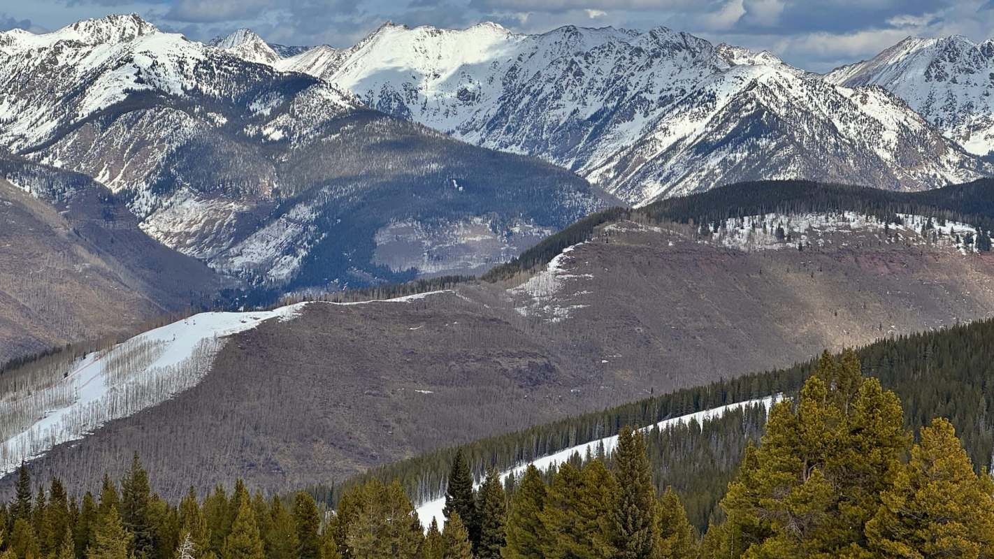
Colorado's mountain snowpack is showing a stark north-south divide, with some northern monitoring sites recording no measurable water stored in snow while southern sites report levels approaching four times normal.
The contrast comes as extreme drought expands in the northern Colorado Rockies, putting further pressure on the region's water resources.
Here's what to know
The National Drought Mitigation Center released the U.S. Drought Monitor map on Nov. 19, using conditions as of Nov. 17. It showed extreme drought covering more of Larimer and Grand counties, according to the Kiowa County Press.
Most drought categories shifted by less than a percentage point statewide, and conditions were largely stable outside Colorado's northern Rockies. The monitor's High Plains summary noted a slight deterioration in that region.
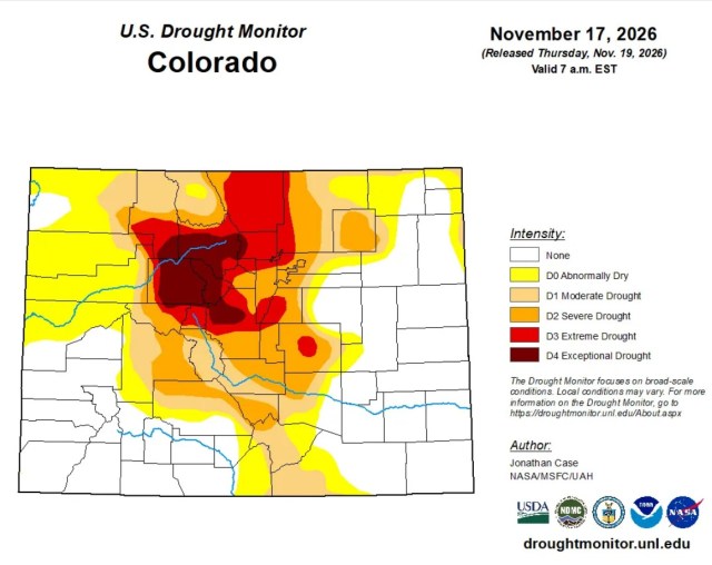
Summit County remained split between exceptional drought, covering 88% of the county, and extreme drought, affecting the other 12%. Exceptional drought, the most severe classification, also persisted across much of the central mountains.
More background
Reliable water supplies support public health, community safety, and local economies.
TCD Picks » Quince Spotlight
💡These best-sellers from Quince deliver affordable, sustainable luxury for all




The Natural Resources Conservation Service's SNOTEL network recorded low snow levels in the northern mountains in its provisional Nov. 19 readings.
Snow water equivalent describes how much water the snowpack holds. The Kiowa County Press cited NRCS readings showing less than one inch at most monitoring sites in Grand, Summit, Eagle, Larimer, and Boulder counties, with several sites registering zero.
Eagle County sites recorded no more than 20% of the 1991-2020 median, while measurements in Grand and Summit counties fell between 0% and 44%.
Most monitoring sites in Summit and Larimer counties received less than 70% of median precipitation for the water year, which began Oct. 1. Totals at most sites in Grand and Boulder counties were below 50% of the median.
What's being done?
The U.S. Drought Monitor and the NRCS monitoring network track different aspects of Colorado's water conditions, including drought extent, precipitation accumulated since Oct. 1, and water stored in mountain snow.
Every monitoring site in Routt County reported less than 1.5 inches of snow water equivalent, even as water-year precipitation ranged from about 57% to 102% of the median, according to the Kiowa County Press.
Snow water equivalent was far above the median for the date at most sites in San Juan, Mineral, La Plata, and Hinsdale counties, with many readings at about 150% to nearly 400% of that benchmark. Measurements ranged from less than an inch to more than 13 inches.
Precipitation since Oct. 1 totaled 2.4 to 4.7 times the median at the cited monitoring sites in those four southern counties. Wolf Creek Summit reported 9.7 inches of snow water equivalent.

Get TCD's free newsletters for easy tips, smart advice, and a chance to earn $5,000 toward home upgrades. To see more stories like this one, change your Google preferences here.