Researchers in Spain and Brazil have introduced a lower-cost way to evaluate rooftop solar in rural settings, making it easier to identify suitable roofs and estimate how much electricity those systems could produce.
What's happening?
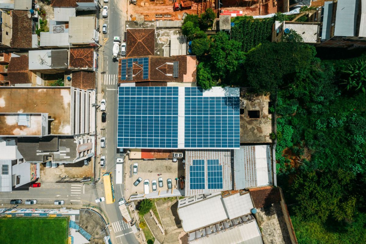
According to PV Magazine, researchers at the University of Jaén in Spain and the Federal University of Bahia in Brazil created a method that combines drone imaging, geographic analysis, and an open-access Python program to estimate how solar could perform on rural rooftops and informal settlements.
The outlet noted that the team tested the approach in two communities in Simões Filho, Bahia — Marielle Franco and Alto da Conquista. The neighborhoods studied had common issues in some informal settlements in the country, including dense housing, lack of land regulations, and improvised electrical networks.
PV Magazine noted that researchers used uncrewed aerial vehicle photogrammetry to produce detailed roof maps, then applied solar irradiance analysis and automated panel-placement software to calculate the potential solar capacity of each rooftop.
In one area, researchers found that around 577 panels rated at 585 watts each could be installed on each home. The energy generated from the panels could offset 61% of the average monthly electricity use, as PV Magazine reported.
Why does it matter?
A clearer understanding of rooftop solar potential could help communities and decision-makers plan projects that lower electricity costs and improve energy access, and a lower-cost way to identify viable solar rooftops can help avoid expensive guesswork and speed up early-stage project planning.
TCD Picks » Quince Spotlight
💡These best-sellers from Quince deliver affordable, sustainable luxury for all




Expanding rooftop solar can reduce reliance on dirtier power sources, cutting the pollution that contributes to climate change and worsens air quality.
As more homes tap local clean energy, cities may also ease pressure on the grid while keeping more energy spending inside the community.
What's being done?
The researchers designed the method to be practical and more accessible than highly specialized modeling alone. PV Magazine noted the process opens with flight planning in Google Earth, then uses drone image collection and processing in Agisoft Metashape to create an orthophoto, terrain models, and a 3D mesh.
After that, ArcGIS Pro is used to examine roof geometry and yearly solar irradiance, while the open-access Python tool compares panel orientations and layout options to determine the maximum number of modules that can fit on each usable roof. It then estimates capacity, projects annual energy generation, and exports the results in shareable mapping formats.
"Energy transition is not only a technical challenge but also a social and territorial issue, directly related to the principles of energy inclusion and socio-environmental justice," the researchers wrote, as reported by PV Magazine.
They added that the findings can help support "fairer and more territorially sensitive public policies."

Get TCD's free newsletters for easy tips, smart advice, and a chance to earn $5,000 toward home upgrades. To see more stories like this one, change your Google preferences here.