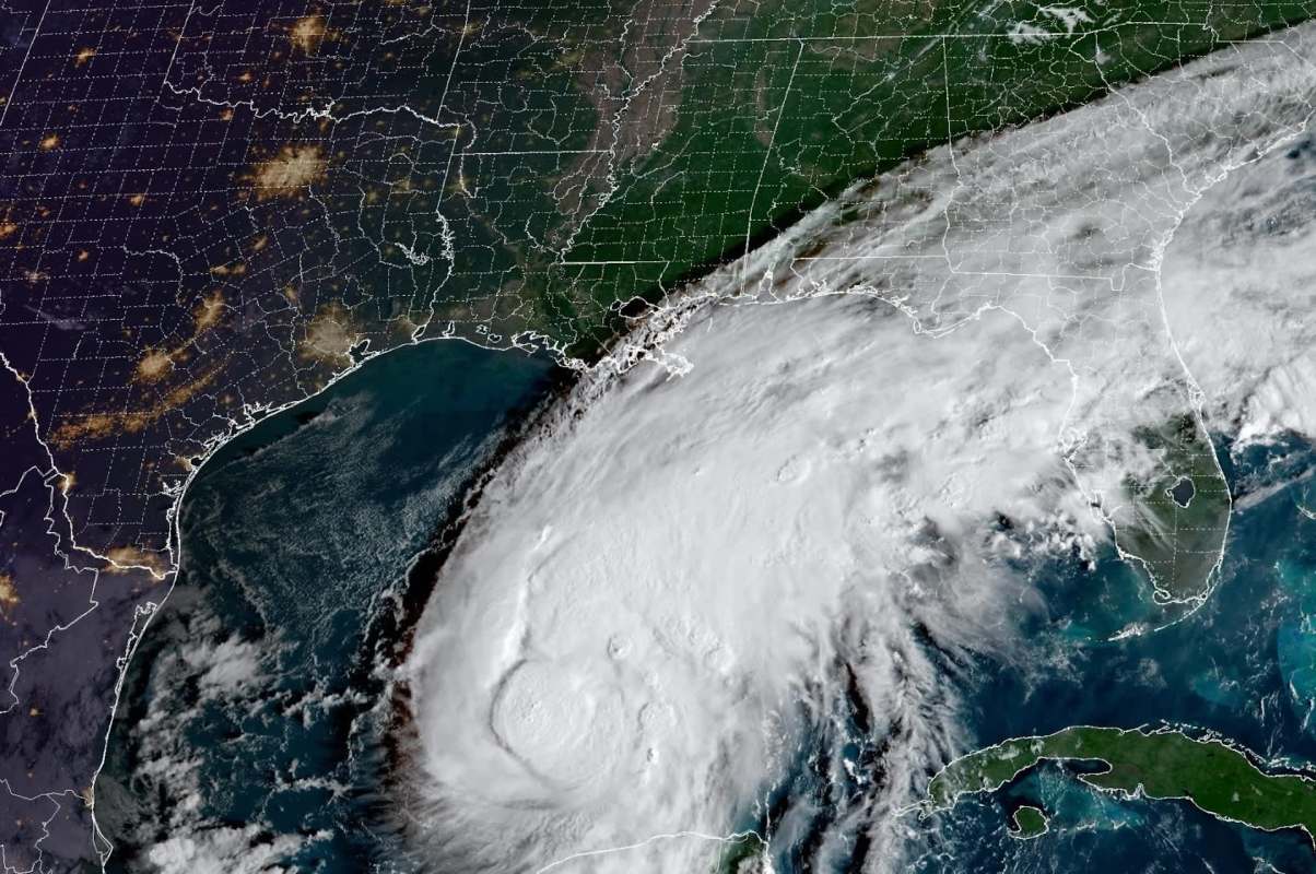
After four months without a single Atlantic hurricane, Isaias is tracking toward the Southeast United States.
Here's what to know
The Atlantic hurricane season runs from June 1 to Nov. 30, and Isaias is the first hurricane of the year. After reaching hurricane strength Wednesday night, Isaias continued tracking toward the Gulf Coast.
By Thursday morning, the National Hurricane Center reported sustained winds of 80 mph and said the storm could reach land by Friday. Isaias was about 420 miles southwest of the mouth of the Mississippi River and moving east-northeast at 8 mph.
Along the Gulf Coast, a hurricane warning is in effect from Ocean Springs, Mississippi, to Florida's Mexico Beach, according to NPR. The Mississippi River to Yankeetown, Florida, is also under a storm-surge watch, and forecasters said water levels could rise 5 to 7 feet. Isaias could also dump 10 inches of rain in some parts.
More background
Philip Klotzbach, a research scientist in the Department of Atmospheric Science at Colorado State University, told NPR it was remarkable to make it to October without a single hurricane.
"While we anticipated a well below-average season this year, it's certainly been surprising to see just how quiet it has been," Klotzbach said.
TCD Picks » Quince Spotlight
💡These best-sellers from Quince deliver affordable, sustainable luxury for all




By Oct. 8, the Atlantic normally would have produced at least five hurricanes, the NHC said. Klotzbach added that records dating back to 1851 show only three seasons made it to Oct. 7 without one, though he speculated that some storms may have gone uncounted before satellites and reconnaissance flights.
The super El Niño climate pattern is widely regarded as responsible for the subdued season because it discourages Atlantic storm development while making Pacific storms more likely. Isaias, however, intensified quickly after crossing Gulf waters with warm sea-surface temperatures.
What's being done?
Storm surges can flood roads, homes, and businesses, while heavy rain can overwhelm drainage systems, disrupting work, school, and access to medical care.
The NHC has warned residents and local governments that dangerous conditions could arrive by Friday.
A silver lining is that Isaias is not expected to stall over areas that are already saturated, even though the threat of heavy rain remains. "Isaias will be moving quickly as it comes onshore, which should hopefully reduce the chances for catastrophic flooding," Klotzbach told NPR.
Where can I learn more?
These stories dig into why the Atlantic stayed quiet for so long — and why hurricane risks can still ramp up quickly. They cover El Niño's role in suppressing Atlantic storms, rapid intensification, warm ocean conditions, and flooding threats beyond the coast.
• This year, El Niño was expected to keep storms quieter while California and Mexico faced risks.
• Scientists watching 2025 were stunned when the Atlantic stayed unusually quiet.
• Forecasters warned that inland residents could face flooding long after landfall.
• Meteorologists say some storms could become much more powerful over very warm water.

Get TCD's free newsletters for easy tips, smart advice, and a chance to earn $5,000 toward home upgrades. To see more stories like this one, change your Google preferences here.