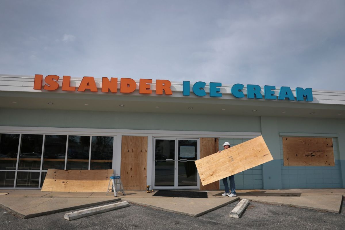
Hurricane Isaias rapidly strengthened in the Gulf, becoming the season's first Atlantic hurricane after its winds jumped 40 mph in just six hours.
As Isaias nears the northern Gulf Coast, officials have issued evacuation orders and encouraged voluntary departures in some areas ahead of threats that include storm surge, heavy rain, damaging wind gusts, and possible tornadoes.
Here's what to know
According to FOX Weather, Isaias is a Category 1 storm with sustained winds of 85 mph and is moving east-northeast at 10 mph. Forecasts call for additional strengthening before it reaches the coast between Gulf Shores, Alabama, and Pensacola, Florida, with roughly 30 million people in Louisiana, Mississippi, Alabama, and the Florida Panhandle in the impact zone.
A Hurricane Warning is in effect from Ocean Springs, Mississippi, to the Bay/Gulf County Line in Florida, and a Storm Surge Warning stretches from the mouth of the Mississippi River to the Suwannee River in Florida's Big Bend.
The National Hurricane Center warned, "The combination of a dangerous storm surge and the tide will cause normally dry areas near the coast to be flooded by rising waters moving inland from the shoreline."
Forecasts show 5 to 7 feet of storm surge for Mobile Bay and the coast from Ocean Springs, Mississippi, to Indian Pass, Florida, FOX Weather reported. Florida Gov. Ron DeSantis and Alabama Gov. Kay Ivey declared states of emergency, more than a dozen Florida counties canceled school, multiple colleges closed their campuses, and evacuation orders were issued for the west end of Dauphin Island in Alabama and for Zones A and B in Okaloosa County, Florida.
TCD Picks » Quince Spotlight
💡These best-sellers from Quince deliver affordable, sustainable luxury for all




More background
The storm's upgrade came quickly. In its 11 p.m. update, the National Hurricane Center still classified Isaias as a tropical storm, but about 30 minutes later, it issued a special advisory saying the system had reached Category 1 strength.
El Niño-driven wind shear helped produce a record-slow start to the Atlantic hurricane season, making Isaias the latest first hurricane to form since the satellite era began in 1966. Meanwhile, Gulf water temperatures are at record warmth in data dating back to 1982, and those warm waters are conducive to tropical development.
NOAA's Storm Prediction Center identified a tornado risk in southern Alabama and the Florida Panhandle, while the FOX Forecast Center said 6 to 10 inches of rain, with localized higher amounts, could trigger flash, urban, and river flooding.
What's being done?
As preparations intensified, Florida's State Emergency Response Team began staging fuel, water, and food under the governor's emergency declaration, according to FOX Weather. Tropical weather advisories also expanded into parts of southern Alabama and southwestern Georgia.
In a joint statement, Gulf Shores and Orange Beach said, "In anticipation of the expected impacts from Tropical Storm Isaias, the cities of Gulf Shores and Orange Beach are encouraging all non‑residents, and residents living in low-lying, flood prone areas to voluntarily evacuate."
NOAA Hurricane Hunters are conducting regular reconnaissance missions to improve forecast data as the storm evolves. According to FOX Weather, Shell and Chevron instituted shut-in procedures or removed nonessential workers from five Gulf facilities; BP said it was securing offshore sites and removing nonessential personnel; and ExxonMobil said operations remained normal as it continued monitoring the forecast.
The storm's exact strength and landfall point remain uncertain.
Where can I learn more?
These stories examine more of the risks around storms like Isaias.
• The NOAA has previously underscored the importance of evacuation planning.
• An above-normal number of storms can test coastal preparedness.
• Experts warned inland communities that hurricane flooding risk skyrockets even far from shore.

Get TCD's free newsletters for easy tips, smart advice, and a chance to earn $5,000 toward home upgrades. To see more stories like this one, change your Google preferences here.