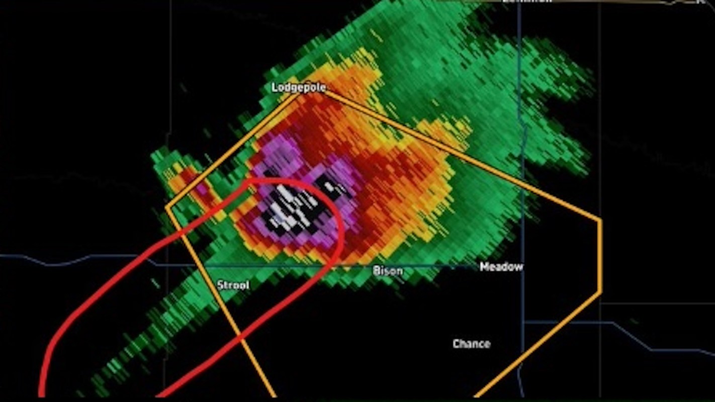
Weather radar can sometimes seem like a secret language, especially when a storm appears to send out a strange streak or echo beyond where the worst weather actually is.
But one unusual-looking feature that caught the attention of weather watchers online has a very real explanation.
Here's what to know
On Aug. 11, a user on Reddit's r/weather asked whether "large hail distorting a radar beam" was a real phenomenon.
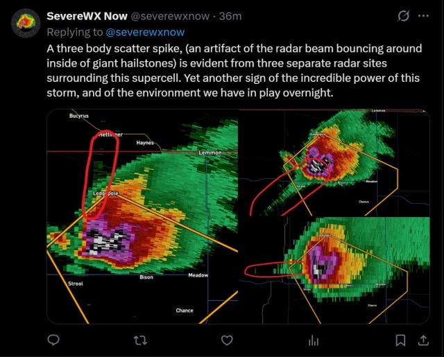
"It seems to make sense, but is this a rare occurrence? And is it always this obvious? Or is something else causing this noise on the radar?" the original poster wrote.
The responses largely said the feature is real and is often referred to as a hail spike.
"Yes it's real," one commenter replied. "You can see it in strong hailstorms and also tornadoes which have lofted a significant amount of debris."
TCD Picks » Quince Spotlight
💡These best-sellers from Quince deliver affordable, sustainable luxury for all




Another commenter compared the effect to GPS problems in dense city areas, where bouncing signals can briefly throw off your location, and described it as "a slightly more complicated multipath problem."
In the radar example, commenters said a delayed return can make the echo show up farther away than the storm itself.
That means the strange streak is not necessarily new weather developing behind the storm.
It can instead be a sign of a powerful storm with large hail aloft or, in some situations, debris.
More background
Radar signatures are among the fastest ways meteorologists and weather-aware residents can gauge how dangerous a storm may be.
While a hail spike does not replace official warnings, it can help explain why a storm suddenly draws concern.
Large hail can damage roofs, vehicles, crops, and windows within minutes. It can also injure people and animals caught outside.
When a radar image suggests hail is large and dense enough to produce this kind of artifact, it may point to a more hazardous storm than a casual glance would suggest.
Commenters also noted that tornadoes can create similar effects when they loft substantial debris. In those cases, radar may show not just precipitation but also how violently the atmosphere is interacting with objects in its path.
Strange radar visuals are not always errors.
Some are meaningful signatures that trained forecasters use to better understand storm severity.
What can be done?
For most people, the best response is not to try to interpret one radar artifact in isolation.
Instead, radar is most useful when paired with alerts, updates from local meteorologists, and severe thunderstorm or tornado warnings.
If a storm appears to have a hail spike or another unusual signature, that is a good reason to pay closer attention, move cars under cover if possible, and get pets and people indoors. Even a brief window to prepare can help reduce the risk of injury and costly property damage.
A commenter suggested educational resources for those seeking a deeper understanding of reflectivity and correlation coefficient data.
Professionals caution against relying on social media interpretation alone when conditions become dangerous.
Official forecasts and warnings remain the clearest guide for making safety decisions in real time.
"Yes, like others have said, this is definitely a thing and is an extremely reliable indicator of large hail aloft, or lofted debris," a user explained.
"'Hail spike' is definitely a top 5 weather term," another commented.

Get TCD's free newsletters for easy tips, smart advice, and a chance to earn $5,000 toward home upgrades. To see more stories like this one, change your Google preferences here.