As regional climates undergo drastic changes and sea levels rise, many homeowners have been left wondering what future risks their properties face.
In response, people living in several high-profile Gold Coast beach suburbs in northern Australia are about to get a new way to better understand the threats facing their homes, including flooding, bushfire, landslides, or dangerous coastal conditions.
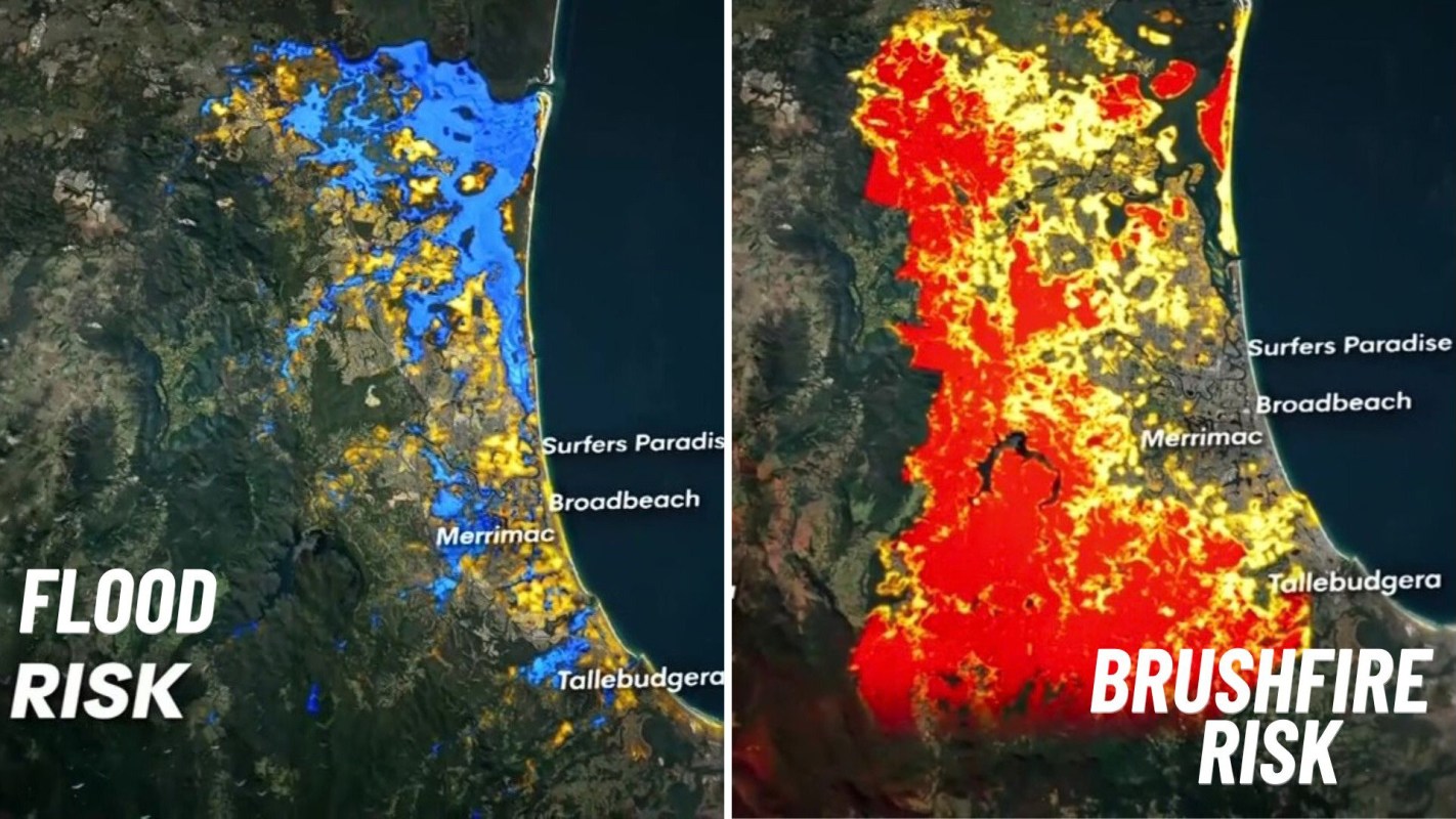
A new, searchable online map detailing such risks covers the northern beachfront and stretches through Surfers Paradise and Broadbeach, with a level of detail so fine that it describes individual properties.
Here's what to know
According to a TikTok video posted by 7NEWS Queensland (@7newsq), Gold Coast Council is preparing a searchable map that identifies which properties are most exposed to extreme weather and coastal hazards.
@7newsq Some of the Gold Coast's most popular beachfront suburbs could face the biggest impacts from extreme weather events, according to new maps released by the council. Residents will soon be able to search for their property to see what could happen, and get ready.
♬ original sound - 7NEWS Queensland
In the video, the map showed flood-prone areas spanning much of the northern beachside strip, covering Surfers Paradise and Broadbeach and reaching inland to locations including Merrimac.
Meanwhile, bushfire and landslide exposure lies in the city's west, including its inland hillside communities.
TCD Picks » Quince Spotlight
💡These best-sellers from Quince deliver affordable, sustainable luxury for all




More background
Elsewhere in southeast Queensland, councils are taking varied approaches to hazard mapping, 7NEWS reported. In Logan, just north of the Gold Coast, more than half of the properties once marked on flood maps have been removed, affecting over 25,000 properties.
The Gold Coast Council said the new maps are being released to build public awareness rather than to drive changes in property prices or insurance premiums.
The regional push for updated guidance extends beyond the Gold Coast. 7NEWS reported that Ipswich published flood guides for seven suburbs it considers highest risk, while Brisbane has been revising maps with updated modeling for key catchments.
Better information can lead to better preparedness
The Gold Coast Council indicated that it wanted the hazard information to be searchable by individual property as a way to help people understand the risks and better prepare for them.
Whether facing floods, wildfires, or anything in between, it is important for residents to understand the risks inherent in their location so they can prepare appropriately. This includes developing an evacuation plan and stocking up on emergency supplies like food, water, and first-aid kits.
Where can I learn more?
The Gold Coast update is part of a broader story about coastal danger, insurance strain, and how households are preparing for worsening extreme weather.
• Across coastal Australia, tens of thousands of homes face sea level threats that could erase value.
• In the U.S., maps reveal states most at risk for insurance spikes from extreme weather.
• Scientists warn urban coastal areas face severe flood risk as rising seas push inland.
• Across the Carolinas, heightened fire risk is growing as drought and flooding compound damage.
• Homeowners are making disaster-proofing home upgrades as stronger storms and floods become more common.

Get TCD's free newsletters for easy tips, smart advice, and a chance to earn $5,000 toward home upgrades. To see more stories like this one, change your Google preferences here.