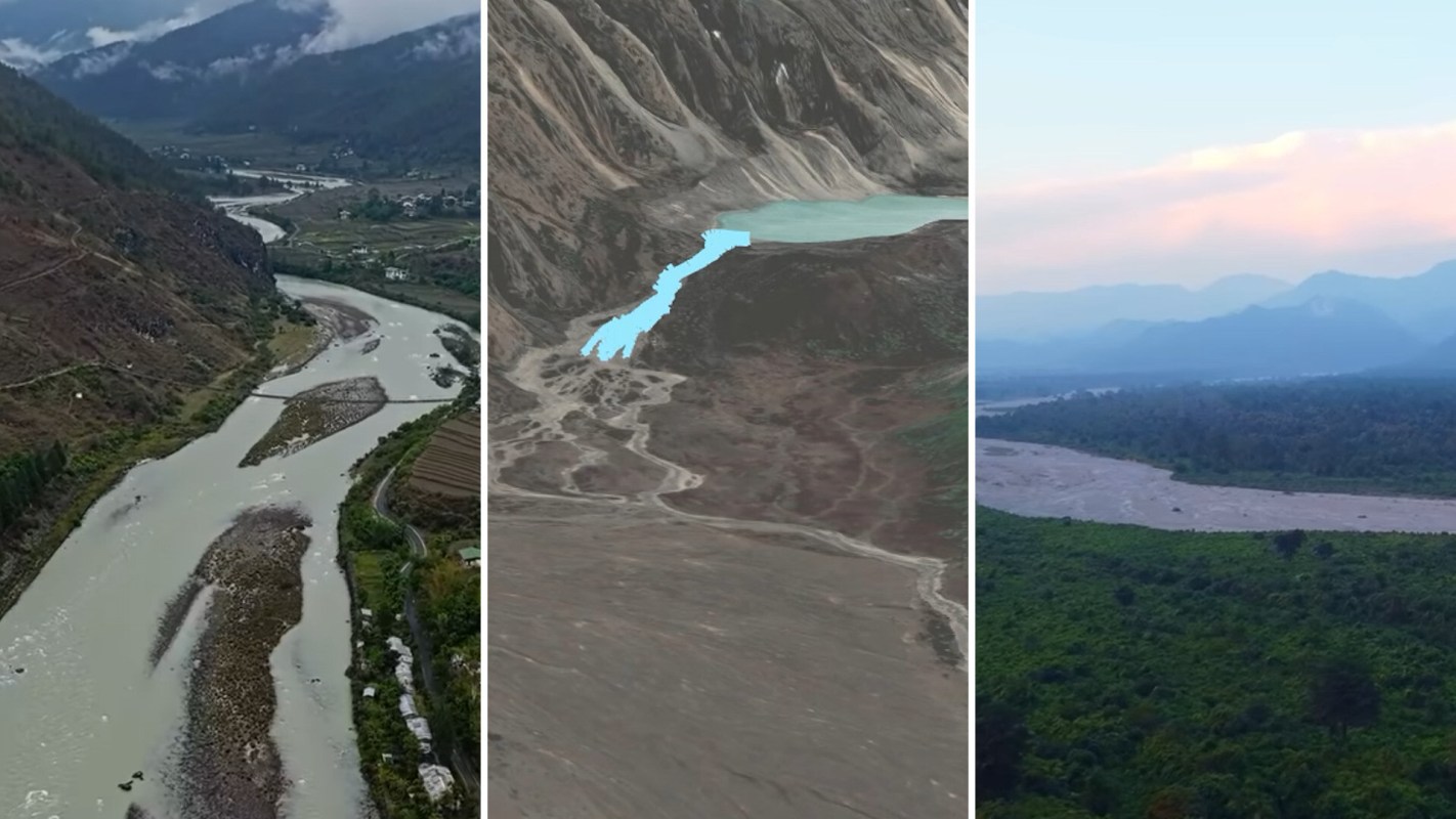
A glacial lake flood in Bhutan destroyed stretches of road and carried boulders and uprooted trees downstream. Thankfully, the disaster claimed no lives, an outcome credited partly to early warnings that arrived before the floodwaters.
Here's what to know
The flood began on Oct. 29 at Shung glacial lake in northwestern Bhutan, about four miles south of the Chinese border, according to GeologyHub's YouTube video.
A tributary of the Mo Chu River carried the escaping water after a section of the lake's natural dam of glacial debris collapsed, the content creator and geologist explained.
The lake sat approximately 14,800 feet above sea level. According to the creator's estimate, 1.9 billion gallons (7.1 million cubic meters) of water could have rushed downstream if the entire lake had drained, picking up sediment, rocks, and eventually trees along the way.
The first populated area was about 14 miles (22 kilometers) downstream. There, the creator's preliminary estimate placed floodwaters at least 30 feet above the river's usual level.
The turbulent water washed away multiple low-lying sections of road and damaged several structures. The highest floodwaters, however, passed through an uninhabited stretch upstream.
TCD Picks » Quince Spotlight
💡These best-sellers from Quince deliver affordable, sustainable luxury for all




More background
An end moraine formed the natural barrier that failed, while lateral moraines contained the lake on two other sides. Shung Lake lay in a depression encircled by these deposits of rock and sediment, which glaciers had transported.
Glacier melt can raise lake levels, putting pressure on these loose deposits. Precipitation, earthquakes, avalanches, and landslides can also destabilize them.
"Anything that adds just enough additional mass or sudden force to a weak point is sufficient," the GeologyHub creator explained.
Heavy rainfall associated with a weakening cyclone was one possible explanation for the dam's failure in Bhutan.
A new lake near a river confluence presented a further hazard downstream. It formed when sediment deposited by the flood at a sharp southward turn temporarily blocked a separate tributary.
What's being done?
The video's assessment also pointed to three geographic advantages: few people living in low-lying riverside areas, low regional population density, and peak flood heights that appeared lower than those of two landslide-triggered floods in Nepal in 2026. The creator credited warnings sent downstream with helping prevent deaths.
The creator also reported that the threat of another outburst from the sediment-dammed tributary lake had been removed. By the time the video was prepared, the original flood had ended.
One user commented on GeologyHub's YouTube video: "Part of what's making forecasting so difficult is there are several different processes that can trigger floods."
Where can I learn more?
Neighboring Nepal faces similar flood risks from glacial lakes and unstable mountain slopes. These stories cover lake-lowering efforts, warming-related collapses, cuts to climate aid, and flash flood damage.
• Nepal is moving to lower four dangerous glacial lakes after floods killed 1,400 people.
• Scientists say warming destabilized a Nepal glacier before a collapse that killed 1,300 people.
• Nepal's deadly floods highlight the consequences of cuts to climate aid programs.
• In Nepal, a landslide-triggered flash flood swept away homes and bridges, leaving five missing.

Get TCD's free newsletters for easy tips, smart advice, and a chance to earn $5,000 toward home upgrades. To see more stories like this one, change your Google preferences here.