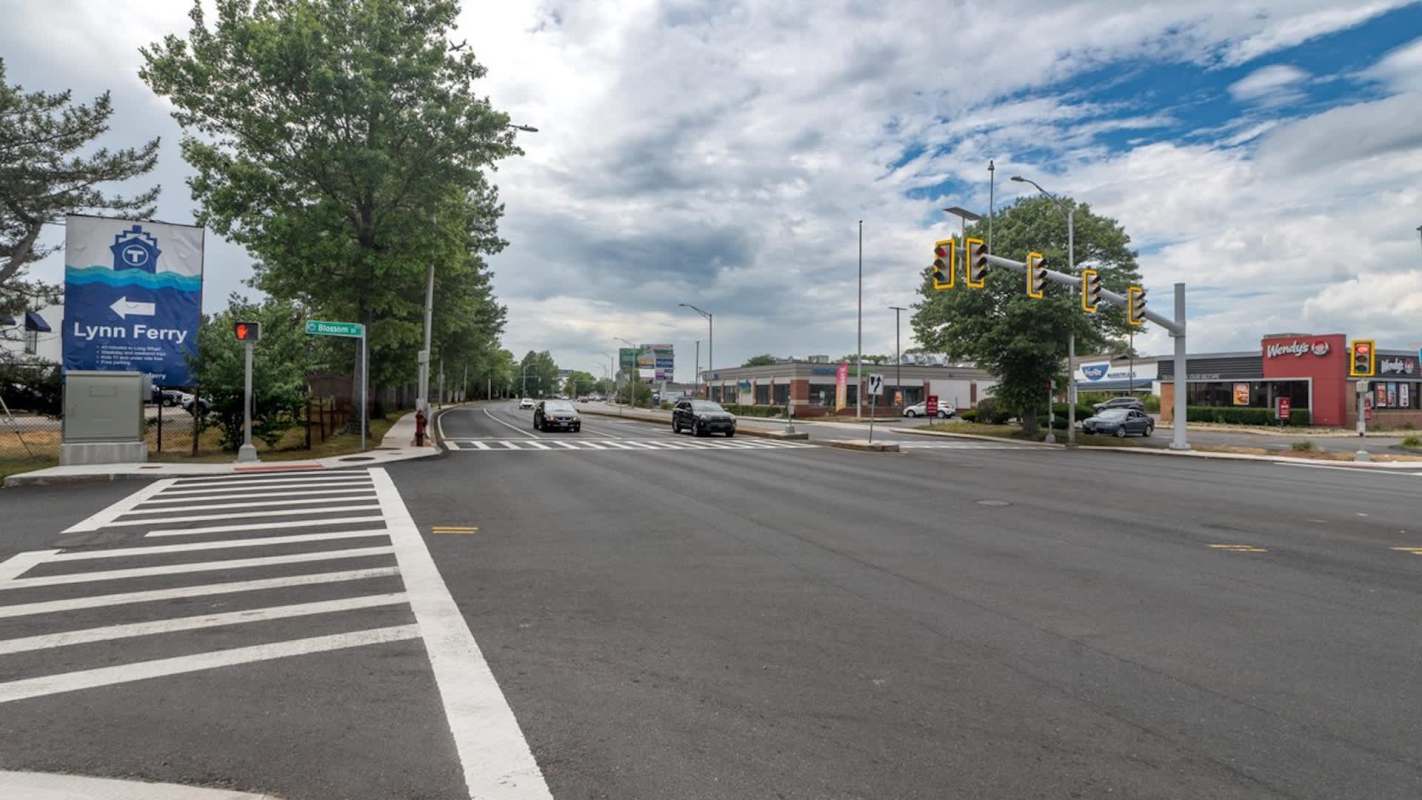
Massachusetts transportation officials say removing one general-use lane in each direction from the Lynnway in Lynn would add only about a single minute to most rush-hour trips. But the state still has not released the traffic counts and modeling behind that estimate, leaving residents and local leaders divided over the future of the corridor.
Here's what to know
According to The Item, state transportation officials based the updated analysis on traffic counts taken in March, then incorporated expected development along the corridor and forecast growth through 2033.
Under the proposal, roughly 2.5 miles of Route 1A in Lynn would be rebuilt with two general-purpose lanes and one dedicated bus lane in each direction, plus protected bicycle facilities, sidewalks, and other pedestrian upgrades.
State transportation officials said they used Synchro traffic software to test two scenarios: a "future no-build" Lynnway and a "future build" version with the redesign in place.
The travel time estimates produced are not based on a before-and-after comparison of today's roadway against the completed project. Instead, the state compared two future scenarios using the same projected traffic volumes.
The Massachusetts Bay Transportation Authority said its model shows about 1 extra minute of travel for most peak-direction trips and a bit more than 2 extra minutes southbound during the morning commute.
TCD Picks » Quince Spotlight
💡These best-sellers from Quince deliver affordable, sustainable luxury for all




The MBTA and MassDOT frame the project as a safety and transit upgrade. The MBTA says more than 3,000 riders use buses on the Lynnway each day, and routes connected to the corridor carry more than 8,500 daily riders.
More background
In a 2016 Route 1A/Lynnway/Carroll Parkway Study, the Boston Region Metropolitan Planning Organization said 2015 traffic counts showed the Lynnway carried about 41,000 to 44,000 vehicles on a typical weekday. The report concluded that the road approached capacity during rush hour while still having unused capacity during other parts of the day.
Beyond congestion, the study identified safety and access concerns including high vehicle speeds, long pedestrian crossings, and limited bicycle infrastructure. It also characterized the Lynnway as a divide between downtown Lynn and the waterfront.
Seeking current vehicle, pedestrian, and bicycle counts along with bus ridership, crash data, and supporting studies, Marblehead resident Adeline Flynn frustratedly asked, "Why? Where is the demand for this?" per The Item.
Opposition has continued to organize. The latest database The Item obtained from the Save the Lynnway campaign lists 1,429 entries submitted from June 11 through Sept. 17, though it is not a scientific survey. The Greater Lynn Chamber of Commerce Board of Directors also voted against the current proposed design, saying business concerns "have not been adequately addressed," The Item reported.
What's being done?
Lynn officials have said the future of the corridor cannot be decided on vehicle capacity alone. Former Lynn Planning Director Aaron Clausen has tied the project to waterfront redevelopment plans, per The Item, while the city called it "a unique, generational opportunity to rebuild this critical roadway."
As the project moved forward, State Senator Brendan Crighton said lawmakers specifically pressed for updated traffic information.
"That was something that we had demanded of the administration and the T, to make sure that we have the most up-to-date information," Crighton said, per The Item. "Obviously, traffic congestion is a concern across the city, but in particular along such an important route."
Critics want clearer safeguards in case the state's projections prove wrong. Marblehead Select Board member Erin Noonan has urged before-and-after traffic monitoring, public reporting for two years after completion, and a commitment from the state to make changes if actual travel delays exceed projections.
The Select Boards of Marblehead, Swampscott, and Nahant sent Lieutenant Governor Kim Driscoll a joint letter asking the state to establish performance measures and mitigation plans as the project moves forward. So far, MassDOT and the MBTA say they factored in emergency access, business and customer traffic, deliveries, and driveway turning movements, but, as The Item reported, they have not identified numerical thresholds for travel time, crashes, ridership, or business impacts that would automatically trigger changes.
"North Shore residents deserve more than projections," Noonan said, per The Item. "They deserve accountability."
Where can I learn more?
For more perspective on the questions at the center of the Lynnway debate, these stories look at road design, traffic tradeoffs, and transportation policy.
• Transit advocates say highway design can reduce traffic when planners account for induced demand.
• In Stockholm, Sweden, residents blasted a massive highway expansion tied to a bridge project.
• In Washington, the Transportation Department rescinded federal vehicle emissions targets and reversed a Biden-era policy.
• Across Europe, road builders are using recycled tarmac to cut construction emissions.
• In Thane, India, officials advanced a new bullet train station to reshape regional travel.

Get TCD's free newsletters for easy tips, smart advice, and a chance to earn $5,000 toward home upgrades. To see more stories like this one, change your Google preferences here.