A powerful El Niño developing over the Pacific Ocean is raising weather concerns around the world, including in faraway New England.
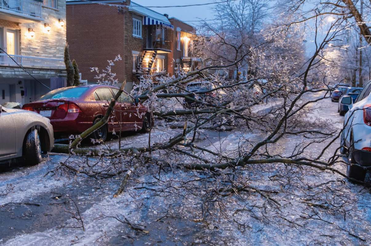
Despite being thousands of miles from the Pacific, New England is likely to feel a significant impact in the form of less fluffy snow and more dangerous ice.
Here's what to know
The global climate phenomenon known as El Niño is often described as the warm side of the Southern Oscillation, a naturally occurring weather pattern. But this year's looks exceptionally intense.
According to NBC Boston, the pattern's eastward-moving waters have become unusually warm and extended deeper into the ocean than in earlier events. Heat like that can alter the larger atmospheric pattern, affecting the jet stream and weather across North America.
For New England, all of this could translate into a winter that feels less predictable than usual. Instead of a season dominated by long stretches of steady cold, forecasters are anticipating a winter that could bring more warmth, abundant moisture, and abrupt temperature swings, all of which creates a perfect recipe for freezing rain.
More background
Despite bringing higher temperatures, El Niño's effect on a given region does not always add up to simply a warmer-than-normal season. In the Northeast, slightly warmer air higher in the atmosphere combined with colder temperatures at the surface can create prime conditions for ice.
TCD Picks » Quince Spotlight
💡These best-sellers from Quince deliver affordable, sustainable luxury for all




When moisture is plentiful in the air, but ground-level temperatures remain near freezing, precipitation can fall as rain before turning to dangerous ice on roads, trees, and power lines. As an example of this phenomenon, NBC reporting pointed to the winter of 1997-98, a major El Niño season during which northern New England experienced a historically destructive ice storm.
Amid the uncertainty, the outlet warned New Englanders not to expect consistently low temperatures this winter. The U.S. Climate Prediction Center's winter outlook also anticipates conditions that could result in more icing events.
What can be done?
In many instances, ice storms can be even more disruptive than snowstorms. This is particularly true on roadways, which can become extremely hazardous with relatively little ice accumulation. Ice-heavy trees can also fall, bringing branches down on electrical lines and knocking out power for days or even weeks.
Being prepared for ice storms and other extreme weather means keeping an eye on long-range forecasts, stocking up on emergency supplies, and making safe backup plans for heating throughout the winter.
Drivers may want to replace worn tires and keep cold-weather supplies in their vehicles, and homeowners may want to keep salt or sand on hand for making walkways safer in icy conditions.
Where can I learn more?
While meteorologists may not be able to predict exactly what this winter's El Niño will bring, they expect that it will be extreme. If you're interested in learning more, you may want to read these stories about how shifting cold-season patterns are already shrinking snowpack, raising flood risks, and worsening winter hazards.
• Across the American West, snow drought wiped out snowmelt reserves.
• In the Great Lakes, blistering winds and feet of snow shattered winter records.
• In California, flood danger is rising as atmospheric-river snow begins to melt.
These pieces paint a broader picture of what happens when moisture and temperatures end up exacerbating the unpredictability of winter weather. It's one reason forecasters are keeping such a close eye on this year's El Niño.

Get TCD's free newsletters for easy tips, smart advice, and a chance to earn $5,000 toward home upgrades. To see more stories like this one, change your Google preferences here.