New research suggests parts of Belize's old-growth rainforest may still carry the imprint of how the ancient Maya used the land thousands of years ago, challenging the idea that mature tropical forests are untouched natural systems.
Here's what to know
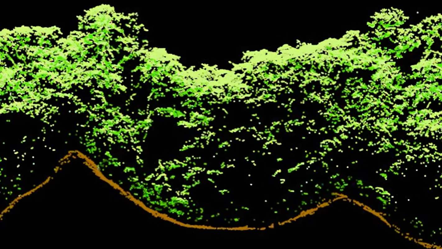
As Phys.org reported, researchers examined Light Detection and Ranging, or LiDAR, scans in Belize and found that even forests that seem largely undisturbed today may still show signs of ancient Maya land use in measures such as canopy height and leaf density.
Archaeologists compared the shape of the living forest with Maya remains concealed below the trees to link present-day forest patterns to older features on the landscape, including buildings and canals.
The results indicated that Maya land use may have had effects that lasted far beyond the civilization itself, still shaping forest growth today, including the height of the canopy and how densely leaves are spread overhead.
LiDAR, which uses laser pulses to map landscapes and vegetation, has become an important tool in both archaeology and ecology, allowing researchers to examine what is happening above and below ground at the same time.
The finding also challenges the idea that a mature tropical forest is always a purely "natural" system with no lasting human fingerprint. In some places, the forest may be thriving in patterns shaped in part by people who lived there long before modern development.
TCD Picks » Quince Spotlight
💡These best-sellers from Quince deliver affordable, sustainable luxury for all




More background
The Maya civilization transformed areas of Central America. Even when visible structures have been reclaimed by vegetation, the land itself can retain those earlier changes.
The research brings together archaeology and forest ecology — two fields that are often studied separately. Rather than looking only for ruins or only for plant patterns, the researchers examined how the two might remain connected across centuries.
If forest structure is influenced by long-ago human activity, scientists and land managers may need to think differently about what counts as "untouched" wilderness and how ecosystems recover over time.
It could also improve understanding of how forests store carbon, support wildlife, and respond to environmental stress. Canopy height and leaf density are tied to shade, moisture, habitat, and the overall health of a forest system.
What's being done?
Researchers are using remote-sensing tools such as LiDAR to uncover hidden relationships between ecosystems and human history. That means conservation planning can be guided by a fuller picture of the landscape, including cultural features that are invisible from the ground.
For archaeologists, this kind of work can reveal where ancient infrastructure once stood without disturbing sensitive sites. For ecologists, it offers clues about why one part of a forest may grow differently from another, even when the areas appear similar today.
Understanding that ancient communities helped shape present-day forests could support management approaches that protect both biodiversity and cultural heritage, rather than treating them as separate priorities.
Studies like this show that environmental protection is often also about preserving history. Forests are not only carbon-rich ecosystems and wildlife habitat; they can also be living records of how people interacted with the natural world over very long stretches of time, just as the Maya legacy may still be written into the Belize rainforest canopy itself.

Get TCD's free newsletters for easy tips, smart advice, and a chance to earn $5,000 toward home upgrades. To see more stories like this one, change your Google preferences here.